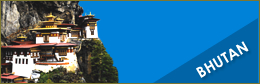
Bhutan » Trekking »
29 Nights 30 days Snowman trek
The Snowman trek is considered one of the most difficult and the toughest trek in the world. The Combination of distance, altitude, remoteness, snow filled passes and weather conditions make this trek very challanging but adventerous and thrilling.
Due to its rigors, it is strongly recommended that all trekkers be in excellent physical condition and determined. An experienced guide will be provided to assist you to set the needed pace for each day of the trek until it is over.
Day 1:
Meet & greet upon arrival at Kathmandu Tribhuvan International (TIA) and transfer to your Nagarkot Hotel.
After check in the Hotel Relaxing
Overnight at Hotel
.
Day 2:
Breakfast at Hotel
Free time till departure
Transfer to the International Airport to connect the flight for Paro
Our representative above will accompany you throughout the trip, you will drive through fascinating valley of Paro and
Overnight in hotel.
Day 3:
Paro – Shana (Trek starts): Distance 14 Km; Time 5 - 6 hours.
Our trek to Shana starts at Drukgyal Dzong following the Paro river and we pass cultivated fields and picturesque villages. The forests are alive with numerous birds and brightly coloured butterflies. Overnight at camp Shana. Altitude 2,820 m.
Day 4:
Shana – Thangthangka: Distance 21 Km; Time 7 - 8 hours.
The trail follows the river through a dense forested area with a few isolated farmhouses. It narrows and closes in and the trail winds up and down along the drainage. We pass a junction enroute, where another path leads north over the Tremo La to Tibet. Overnight camp at Thankthangkha.
Altitude 3610 m.
Day 5:
Thangthangka – Jangothang: Distance 15 Km; Time 5 - 6 hours.
In the morning after passing a small army post, the trail slowly leaves the forest line and gradually climbs into a beautiful valley, passing Tegethang, a winter home of yak herdsmen. Lunch will be served in one of these huts. Lots of yaks will be seen before arriving at the Jhomolhari base camp (4,115 m). High mountains overlook the camp and visible nearby are the ruins of an old fortress used to guard Bhutan against Tibetan invasions. Camp at Jangothang. Altitude 4,115 m.
Day 6:
Jangothang (Acclimatization): One day halt at Jangothang. Enjoy the superb view all around.
Day 7:
Jangothang – Lingshi: Distance 18 Km; Time 7-8 hours.
The trail follows the stream for half an hour and crosses the bridge to the right side. Start the climb up to the first ridge with a breathtaking view of Jumolhari, Jichu Drakey and Tsrim Ghang. Then walk towards the valley, almost flat for a while, until the climb to the Nyeley la pass at an altitude of 4,700 meters. After the pass, it’s a gradual descent to the Lingshi camp, enjoying the panorama view of the peaks and Lingshi dzong. Overnight camp at Lingshi. Altitude is 4000 meters.
Day 8:
Lingshi – Chebisa: Distance 12 Km; Time 4-5 hours.
Walk past the Lingshi dzong, perched on the hilltop with a commanding view of green hill, the Winding River and magnificent peaks. This is a very easy day and a pleasant walk, through villages and yak herders camps. Lunch will be at scenic Goyuna village. After lunch, a short walk will reach you to Chebisa village. Overnight camp at chebisa by the side of stream. Altitude 3,850 m.
Day 9:
Chebisa – Shomuthang: Distance 17 Km; Time 7-8 hours.
Today begins with a stiff climb up a ridge to Gubula pass at an altitude of 4,500 meters, taking nearly 4 hours to the top. After the pass descend to a lunch spot, through rhododendron bushes. Afternoon continue along the up and down path, after crossing the stream, through rhododendron forests and yak herders camps. You may see herds of Blue sheep. Overnight camp at shomuthang.
Altitude 4260 m.
Day 10:
Shomuthang – Robluthang: Distance 15 Km; Time 7-8 hours.
The trek starts with a climb to Jari la pass at the altitude of 4,600 meters. Then descend to Tsharijathang valley, the summer residence of the rare Himalayan Takin (national animal of Bhutan). From here we may have to cross the stream and get wet, as most of the time the foot bridge is washed away. After crossing the stream the trail ascends till you reach Robluthang camp.
Altitude 4400 m.
Day 11:
Robluthang - Lemithang: Distance: 19 km; Time 7-8 hours.
The trek starts with a long climb up to the shinje la pass (altitude 4900meters). Mountains views from the pass are breathtaking. Then descend to Lemithang. The path is quit narrow and you may have to cross the stream and get wet again. The last part of the trek is very interesting, with the view of Mount Gangchey Ta peak. Arrive at camp.
Altitude 4100m.
Day 12:
Limithang to Laya Distance: 10 km; Time 6-7hours.
You will follow the valley down parallel to the Timuchang Chhu through a cedar and then fir forest. Yak people from Laya might overtake with their yaks carrying loads of smuggled goods. About 30 minutes before reaching Laya, there is a clear split in the trail. The left fork is better. After some small ups and downs and crossing a ridge you reach a chorten and a prosperous Laya village appears before you. Altitude: 3800m.
Day 13:
Rest day at Laya (Acclimatization): Explore around the village. You can go and visit any of the houses around. By tradition one can go to any house without an invitation. A cup of tea or Chang (local drink) is always offered. The people in this village are very interesting with a unique dress, language and and traditional ornaments.
Day 14:
Laya – Rhodophu: (Distance: 19 km; Time 7-8 hours)
From Laya, the path descends to the army post and it continues to follow the river till the turn off point to Rhodophu. After lunch, continue the climb through rhododendron bushes. Camp overnight at Rhodophu. Altitude 4,350m.
Day 15:
Rhodophu to Narethang: (Distance: 16 km; Time 7-8 hours)
We have a long hike today as we climb to Tsimola La (15,429 ft). After crossing the pass and from a little summit, there is a great view of Lunana, Mount Jumolhari and Jichu Drake. Descending to Narethang we pass dwarf rhododendron and hike in the shadow of Gangla Karchung peak.
Altitude 4940m.
Day 16:
Narethang – Tarina: (Distance: 19 km; Time 7-8 hours)
The path is flat for another four hours till the climb to Gangla Karchula pass (5,080m). The view from the pass is breathtaking. The whole range of mountains, including Masagang, Tsendegang, Teri Gang can be seen, after the pass there is a very long descent to Tarina valley. Altitude 3,980m. Walking time 10-11 hours.
Day 17:
Tarina – Woche: (Distance: 14 km; Time6-7 hours).
The day is much easier as the path follows the river down valley. Today you will walk for around 1 hour parallel to the Tarina Chhu, surrounded by some beautiflu water falls. Later the trail becomes muddy through the forest and after 30 minutes starts climbing steeply, crossing landslide areas.You might reach Woche village bit early and perhaps early for lunch also. Therefore we will move ahead to a good campsite which is around 1 hour 30 minutes walking. Altitude: 4163m.
Day 18:
Woche – Lhedi: (Distance: 13 km; Time6-7 hours)
The Trek starts through juniper and fir forests and then through rhododendron bushes. We climb up to Keche la pass (4,480m) where one can have a great view of the mountains. After the pass, descend to the river walking through the village with stunning views of Table Mountain and others. Follow the river, one of the main sources of Phochu, till Lhedi village. Altitude 3,650m.
Day 19:
Lhedi – Thanza: (Distance: 17 km; Time7-8 hours)
The trek continues following the river, rising gradually to Choejong village. After lunch visit the Choejong dzong and continue towards the wide valley. Cross the bridge to reach Thanza camp Altitude 4,000m
Day 20:
Thanza – Tsorim: (Distance: 19 km; Time8-9 hours)
The trek starts with climb up to the ridge with great view of the Table Mountain and Thanza valley below, The ridge altitude is 4,500 m and rises gradually up to 4,650m near by the foot bridge. After lunch walk up towards the left side of the bridge enjoying the views of the snow peaked Mountains. Climb up ridge after ridge until you reach the camp at Tsorim at the altitude of 5, 150m. Then down to the camp. Altitude 5125m.
Day 21:
Tshorim - Gangkar Puensum base camp: (Distance: 15 km; Time6-7 hours)
This is the highest of the trip and we start the day with a short climb to the Tshorim lakes. Walk on the side of the lake enjoying the panoramic views of the Gophula ranges. The last climb to Gophula pass (5,230m) is very short. After the pass descend to the base camp walking along the ridge. Enjoy the great view of Gangkar Puensum. Those with a lot of energy can divert to the left side to climb up the Pyramid Peak for better view. Others can go down to the base camp nearly Sha Chu at the Altitude 4,970m.
Day 22:
(Acclimatization): Rest day at the base camp. Enjoy the great view.
Base camp - Geshe woma: (Distance: 15 km; Time6-7 hours)
Time to leave the beautiful mountains, but the trek is far from over. The path follows the Sha Chu and descends gradually to Geshe woma. Altitude 4,200m.
Day 23:
Geshe woma – Warathang: (Distance: 19 km; Time8-9 hours)
The path continues following shachu for two and a half hours until the stiff climb to Sakala begins. Visibility along the Sakala trail is poor so one must watch the top of the ridge for guidance. Lunch nearby a yak herder’s camp. After lunch climb up to Sakala pass at the altitude 4,800m. Descend to the lakes and another short ascent to Wartangle pass (4,590m). The scenery once again is stunning with small lakes and mountain peaks. Camp at the altitude of 4,000m.
Day 24:
Warathang - Dur Tsachu: (Distance: 17 km; Time5-6 hours)
A short half hour climb to Juelela (4,400m). After the pass descend to the riverside through dense rhododendron, juniper and conifer forest. After the bridge a little climb to Dur Tsachu hot spring, where Guru Padmasambava is supposed to have bathed in the 8th hot spring. Walking time 5 hours.
Day 25:
Dur Tsachu –Tshochenchen: (Distance: 19 km; Time8-9 hours)
Today we go across the last pass of the trip (Juelela pass). From the stream it is along and steady climb again with great views of the mountains in Lunana. One comes blue lakes and yak herders camps to arrive at the Thochechen camp at an altitude of 3,850m.
Day 26:
Tshochenchen – Dur – Jakar:
This is the last day of the trek. Here we change from yak to pack ponies for carting trekking gear. The path follows the Chamkhar Chu, descending gradually with few climbs. The trek ends when you arrive at Dhur village. Our travel representative will be at Dur village to pick you up and proceed to Jakar (Bumthang). Overnight at Hotel.
Day 27:
Jakar – Wangdi: Start early to visit some of the famous monasteries in Bumthang and drive to Trongsa (70km) for lunch at local hotel. After lunch drive to Wangdi (130km) via Pelela. Overnight at the the the the lodge.
Day 28:
Drive to Thimphu: (68km) Morning, visit to historical sites in Wangdue and Punakha.Afternoon, Drive to Thimphu. Overnight at Thimphu. Special farewell dinner and get together by the Company.
Day 29:
Breakfast at Hotel
We leave early to catch your onward flight from Paro airport at Transfer to the Airport to connect the flight for Nepal
Arrival at Kathmandu check in to the Hotel
Overnight at Hotel.
Day 30:
Breakfast at Hotel
Free till Departure then Transfer to the Airport to connect the flight for onward journey.
Trip Facts